- Sunda
- Dieng Plateau
- Sunrise, Craters, and Lakes
Golden Sunrise, Craters, & Lakes in Dieng Plateau
Golden Sunrise in Dieng Plateau
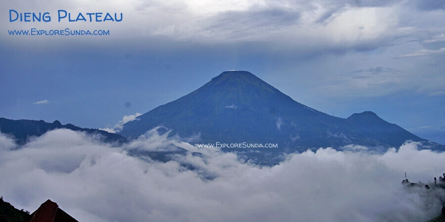
In Dieng, the scenery is simply stunning. The area is encircled by Mount Prau (2,590m), Mount Sindoro (3,136m), Mount Sumbing (3,371m), and Mount Bismo (2,365m). The roads throughout Dieng are narrow and winding, and fog frequently blankets the area day and night. Due to the low-level clouds being below two kilometers above ground and the Dieng Plateau being higher than that, you can visit some high points in Dieng and look down on the clouds below you. This is why Dieng is often called Negeri di Atas Awan, which loosely translates to Land Upon The Clouds.
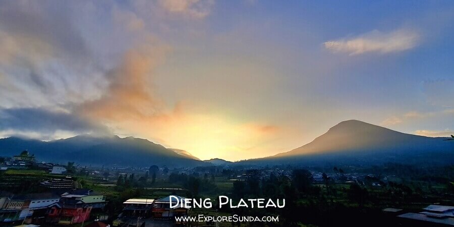 Start your day in Dieng Plateau with the Golden Sunrise.
The mountains in Dieng are popular among mountaineers, with Mount Prau being a favorite among hikers due to its breathtaking view from the top. "Prau" is derived from the word "Perahu," which means "boat" in English. This is because the mountain resembles a boat with thick clouds on its side that look like wave foam.
The best view of the Dieng Plateau is during sunrise. People call it the golden sunrise when the sun shines from behind a mountain with clouds hanging on its sides. At that time Dieng truly became Negeri di Atas Awan.
Today, you don’t have to climb mountains to enjoy this stunning view. One of the places to see clouds and fog below you is the Rest Area Si Gemplong Tol Kahyangan (loosely translated as Rest Area of Highway to Heaven). You will pass it if you go to Dieng via Bawang. At the summit of this hill, you will see the stunning landscape of the surrounding mountains.
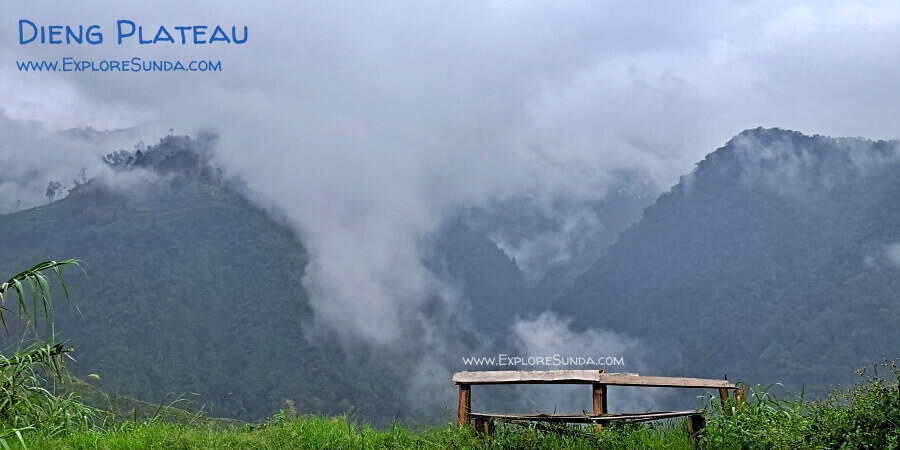 One rainy and foggy afternoon at Rest Area Si Gemplong Tol Kahyangan brought a magical ambiance in Dieng Plateau.
Besides the summit of Mount Prau and Tol Kahyangan, other popular spots to see the sunrise are at Bukit Sikunir (GPS coordinates are 7°14'19.8"S 109°55'27.6" E), Maha Sky Batu Angkruk, Bukit Sikapuk, Pintu Langit, Bukit Skoter, and Gardu Pandang Tieng.
Maha Sky Batu Angkruk is a garden on the edge of a hill and it provides steel bridges and glass platforms with a view of Mount Sundoro. Pintu Langit, Bukit Awan Sikapuk, and Gardu Pandang Tieng also offer a place to see sunrises on various platforms, such as glass bridges, benches, etc. On average, the entrance ticket to each of these sites is Rp. 15,000.
You can easily rent cars or tours if you want to go to these locations, but you have to start as early as 4 AM! In my experience, as long as you are in the open on high ground without tall buildings or towers nearby, you can see the sun rise from behind a mountain. For example, I watched the sunrise from the rooftop of my hotel at 6 AM. Of course, it all depends on the weather. Sometimes, rain and fog obscure the sunrise.
Still, the best view of the golden sunrise in the Dieng Plateau is from the top or slope of a hill facing valleys and mountains. From this angle, you will see thick clouds covering the middle section of the mountain and the golden sun rising from behind it.
Although not so many people are eager to chase sunsets, the sunset in Dieng is also beautiful and has calming and peaceful vibes.
If you stay in villas such as Pintu Langit and Bukit Awan Sikapuk, you can watch sunrises and sunsets from the comfort of your villa!
Seven Volcanic Craters in Dieng Plateau
The Dieng Plateau is home to several active volcanoes, with craters that emit bubbling sulfur gases. One of the most well-known craters is Sikidang, named after the Javanese word for deer. It got its name because the gas in this crater emerges in small bursts that resemble a deer jumping around. This phenomenon inspired the legend of Prince Kidang.
In addition to Sikidang, other known craters in Dieng are Sileri, Candradimuka, Sibanteng, Siglagah, Sinila, Timbang, and Sikendang. These active craters emit a foul smell of sulfur and sometimes discharge toxic gases. That's why they are closely monitored and will be temporarily closed, whenever they pose any danger or harm. Among them Kawah Sileri is the deadliest crater in the Dieng Plateau. Its phreatic eruption in 1964 destroyed an entire village. The locals remember it by telling the story of an evil witch and its enchanted leri (the remnants of rice washing).
In addition to tourism, these active volcanoes provide energy for geothermal power plants. The pipes used for transporting it look like a giant snake zigzagging up high in the mountains :)
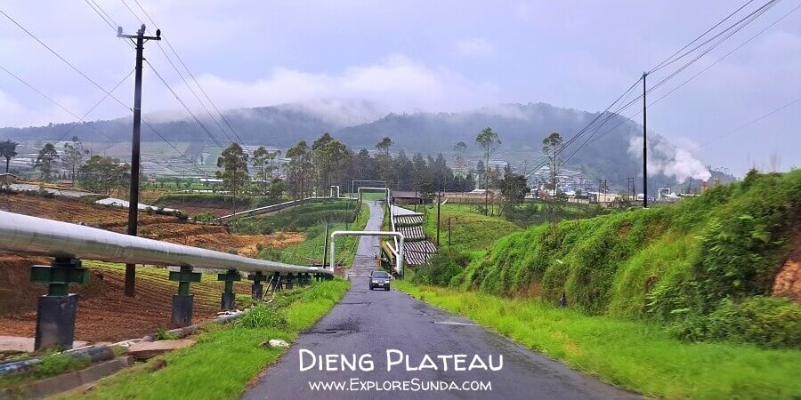 Pipes from the geothermal power plant zigzagging in the mountains of Dieng Plateau.
Beautiful Lakes in Dieng Plateau
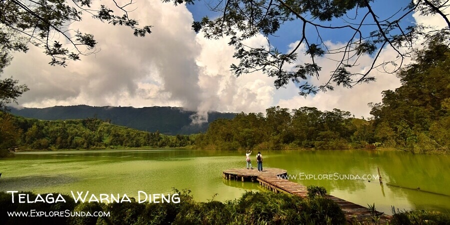 The breathtaking view of Telaga Warna in Dieng Plateau.
Opening Hours:
07.00-18.00
Ticket:
Rp. 22,000
Telaga Warna, which translates to Colorful Lake in English, is one of the primary tourist attractions in the Dieng Plateau. The lake undergoes color changes, ranging from greenish to yellowish, with some people likening its appearance to that of a rainbow. These color variations occur as a result of fluctuations in the sulfur concentration in the water, which is reflected by sunlight. It seems the sulfur originates from Sikendang, a somewhat toxic crater located northwest of Telaga Warna.
Although you are not allowed to swim in Telaga Warna, you can walk around the perimeter of the lake, capture the surrounding beauty, and visit Sikendang Crater, Semar Cave, Gua Sumur (or Well Cave in English) with its small pond called Tirta Perwita Sari (loosely translates as Spring of Life), Jaran Cave (Jaran is a Javanese word for horse), Batu Tulis, and Pengilon Lake.
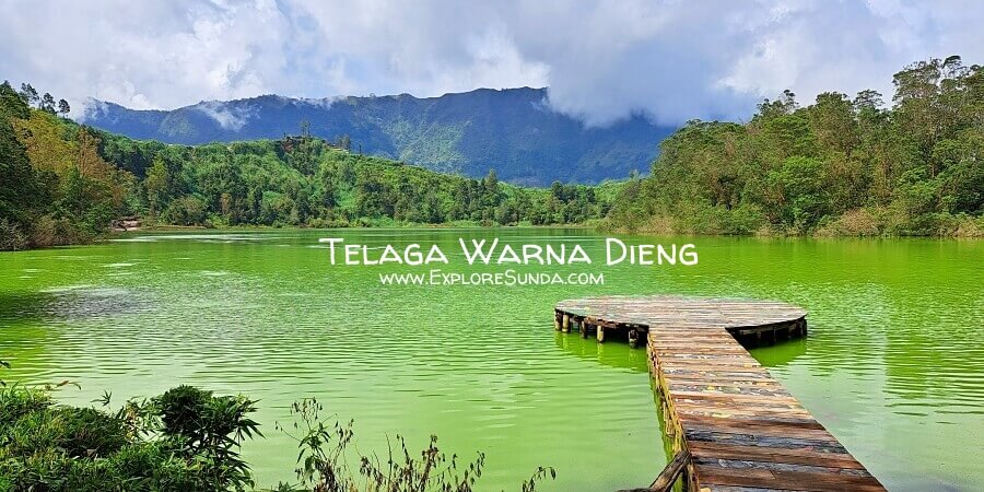 Enjoy the serenity of Telaga Warna, the ever color changing lake in Dieng Plateau.
Pengilon Lake is situated on the eastern side of Telaga Warna. It is smaller than Telaga Warna, but its water is clear like a mirror (Pengilon is a Javanese word for mirror.) The myth surrounding this lake is that if you look at its surface and your reflection is clear, it signifies that you are a good person.
Another way to enjoy the beauty of Telaga Warna and Telaga Pengilon is by climbing Batu Pandang Ratapan Angin, where you can have a bird's eye view of these two lakes. Batu Pandang Ratapan Angin means "a lookout where you can hear the sound of wind weeping," which is a famous legend in Dieng.
Apart from the well-known Telaga Warna, the Dieng Plateau is home to several other beautiful lakes waiting to be explored. They include:
Telaga Merdada:
At 2,045 meters above sea level and surrounded by Pangonan and Semurup Hills, this 25-hectare lake resembles a large reservoir as it solely relies on rainwater and has no natural water source.
Telaga Cebong:
Nestled under Bukit Sikunir, this picturesque lake is a popular destination for tourists after they watch the sunrise at Bukit Sikunir.
Telaga Balekambang:
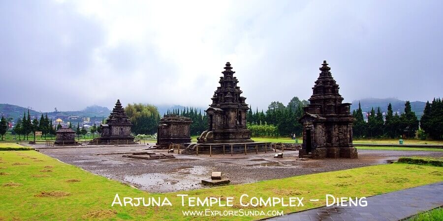
Located near the Arjuna temple complex, the locals considered it sacred. Hence, they conduct rituals such as drifting the dreadlocks from Ruwatan Rambut Gimbal into the lake and performing the Syiwalatri ceremony to cleanse people from misdeeds and wrongdoings in Telaga Balekambang.
Telaga Dringo:
When Mount Sinila erupted in 1786, it created a large crater that later became Telaga Dringo. Today, at 2,265 meters above sea level, Telaga Dringo is the highest lake in the Dieng Plateau. Access to this lake is a bit remote, hence, you might want to hire a four-wheel-drive (locals called it a jeep) to take you there. You only need to walk a short distance from the parking lot, to see the beauty of Telaga Dringo. To get a closer look, you'll need to hike on a slippery dirt path to reach its shores, although, many visitors find the bird's eye view is better than seeing it up close. Telaga Dringo is also a popular place for camping, with tents available for rent on-site. While at it, you might also order grill packages for your dinner :) You also can see stunning sunrises and sunsets from the nearby hill of Puncak Sawangan.
Telaga Menjer:
This lake was formed when Mount Pakuwaja erupted. With the view of Mount Sindoro, Telaga Menjer is the largest lake in the Dieng Plateau, covering 70 hectares and reaching a depth of 45 meters in some places. Today, its water is used for irrigation and a hydroelectric plant. The popular mode of water transportation here is Getek – rafts made of bamboo, which are available for rent to cruise around the lake.
Recent Articles
-
Kawasan Wisata Punclut Bandung: Cafes & Views in Sarae Hills
Jan 28, 26 04:03 AM
Discover Punclut Bandung at Sarae Hills—cool breezes, sunset views, and cliffside cafes with photo spots, playgrounds, and diverse dining options. -
Roro Jonggrang: A Tale Etched in the Stones of Prambanan Temple
Nov 05, 25 11:52 PM
Unravel the ancient Javanese legend of Roro Jonggrang that bridges myth, devotion, and the grandeur of Prambanan. -
Discover the Vibrant Celebration of Imlek in Indonesia!
Jan 13, 25 03:24 AM
The Chinese New Year of 2576 will be celebrated on January 29, 2025. Discover the special things in this Imlek festival!
